 Tweet
Tweet
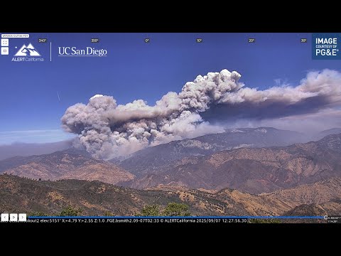
Looks like this thing has developed into a beast and from what I can see it is devouring timber that hasn't burned in generations and has a pretty clear path all the way to Shaver Lake in the direction it's been moving. It burned through Teakettle, an experimental old growth forest area down from Wishon but then moved off to the northwest and west, overrunning Fence Mountain.
Fortunately, until it gets to the Shaver area, there are relatively few structures threatened. Here's some resources....
Watch Duty...
https://app.watchduty.org/i/61327
SAR Topo, showing fire topography and fire history layers.
https://sartopo.com/map.html#ll=37.0...ent%2Cmodis_mp
Fence Mountain lookout cameras...
https://cameras.alertcalifornia.org/...MeadowLookout2
I found this channel to have some good analysis on the fire, and CA fires in general, from a fire professional perspective...


